Cabins, Waterfalls and Horses
In Kelowna I scoured book stores and the web for info on Wells Gray Park but only managed to have success online. Though www.wellsgray.ca helped me make a few plans, I'm old school and need to see maps, photos and descriptions spread out before me, like a general preparing to invade and conquer. Once we hit Clearwater, I looked forward to getting some of those colourful glossy brochures with things to see and do, just like all the ones we have at tourist info booths in Kelowna.
We arrived at the Visitors Information Centre around noon and though the staff was very nice, I didn't find them all that helpful. Maybe I just didn't ask the right questions. There were no Wells Gray brochures. The best they could do was a legal sized paper with a map of the park and tiny dashed lines showing the hiking trails, almost too small to read. There was a binder with more detailed maps of each hike, but you couldn't purchase copies of them. I didn't plan on driving back and forth to the info centre each day to make my plans. We wandered around the gift shop and I discovered a book titled Exploring Wells Gray Park by Roland Neave. Though I hesitated at spending $20 on something that might end up being useless, it turned out to be worth it's weight in gold, filled with accurate information on hikes, waterfalls, lakes, places to stay and smatterings of history. The first section goes along Clearwater Valley Road kilometre by kilometre describing many if not all of the sights to see and things to do. This is the south west corner of the park, just a small portion of the 1.3 million acres of wilderness. We filled Wednesday afternoon to Sunday morning quite easily, still leaving lots to do on another trip.
Before we reached our accommodations we saw a sign for Spahats Falls at around the 10k mark. The book said it was only a 250m walk from the parking lot we decided to stop for a quick peek. Many of the waterfalls in Wells Grey are accessible by vehicle with clear paths and viewing platforms. Many also have hiking trails leading you to the base of the falls, or an area with a different perspective. You can pick and choose which ones you want to hike to depending on difficulty and time constraints.
Can you see the viewing platform at the top of the cliff?
The view from just above the falls.
Without a person or something nearby to give perspective the photo doesn't really do justice to the 75 m drop. The first glance really took my breath away since I was not expecting anything quite so impressive.
Next stop Across the Creek Cabins.
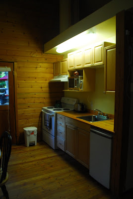
These cozy little cabins were nestled amongst the birch and aspen not far from the main road, but the trees dampened any noise other than birdsong and the rush of the creek behind us. As directed, upon our arrival we gave the owners a call and Joan came over to answer any questions we might have. When we asked her what we should see she was very helpful, much more so than the info centre.
After we unpacked we drove up the Clearwater Valley Road (which by the way is a paved two lane highway in very good condition), to Moul Falls. Everything is really well marked as was the case everywhere we went in Wells Gray. There were even signs at two more points along the trail, telling you how much farther to go, both in kms and in sometimes in minutes as well.
There are many rocks and roots along the path and as we took in the beautiful wilderness that surrounded us, we stumbled more times that I care to admit. Mother was right as always...lift your feet!
We hiked along the trail that grew more dense, narrow and hilly as we followed Grouse Creek to the base of the falls, descending about 130 m.
Unfortunately we were unprepared to go behind the falls as I wasn't willing to risk damaging the camera. Something to put on the list for next time!
 There were beautiful views to marvel at, all along the Clearwater Valley Road.
The following morning we headed over to Helmcken Falls Lodge where I'd arranged for us to take a trail ride via horseback . I booked the three and a half hour ride because it covered a lot of ground and I figured we see a variety of landscapes. The goal was to get to the historic Bee Farm built in 1913 by sisters Jessie and Frances Emery. I thought it might be a nice spot to visit.
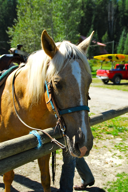
Mike's horse named Angel
My horse...Bimbo
After a long introduction for beginner horseback riders and a description of what to do if we came upon a bear or if the horses were stung by the many wasps that had built their nests along the trails, Cowboy John from London, England took the lead.
It was a lovely way to spend a warm summer morning. We ambled our way through sun dappled forests of pine, poplar and birch, the ground thick with thimbleberry bushes. We followed hiking trails, cross country ski trails and snowmobile trails. I'm glad we hadn't decided to do the 5k hike to the bee farm from farther up the road. I'm sure we'd have gotten lost in the thick underbrush and I much preferred running into a bear on horseback than on foot. The horses shied at a couple of times along the trail and we heard the crack of large branches at one spot. There were definite signs that bears were about. So many of the tourists we ran into over the week were hoping to see a bear but having one try to get into our cabin one night when I was a child, I was happy to skip the experience.
Evidence of bears...
A restored bee farm building.
This one looks like it has a few more original parts.
Stopping for a drink on the way back. John on his horse whose name escapes me at the moment.
We were required to wear helmets.
For previous posts in the Clearwater area check out Enjoying Alpine Meadows Resort.


Comments
Post a Comment